Please like Wild Trips FB page. The madmen who spent nights working at this website will be grateful! (And you'll get updates, new travel infos and photos)
Please like Wild Trips FB page. The madmen who spent nights working at this website will be grateful! (And you'll get updates, new travel infos and photos)
Travel itineraries, hiking, kayaking and sailing in Italy and around the world
In Liguria there are many hiking trails, some really famous, but also the less known trekking itinerary from Recco to Genoa Nervi, passing through
Sori and Bogliasco, is really amazing, with lots to see. In addition to the Mediterranean sea, this trail allows you to admire characteristic villages, olive groves and hilly landscapes.
In short, a highly recommended route that ends on the beautiful sea promenade of Genoa Nervi. Olive trees along the path between Recco and Sori
In total, we took 5 hours for the route, with a short lunch break. The overall difference in height, given
from the various ups and downs along the path, is about 800 meters, the length of the whole itinerary is 13-14 kms. You may also split the hiking route into
different stages, taking advantage of the railway stations of Sori and Bogliasco (in addition to those of Recco and Nervi). Recco and its houses by the sea: the starting point of our trek
So we start from Recco. From the station you walk down to the sea and then continue to the west, following the coast
and the small marina. With a short staircase you go up to the road that connects Recco to Mulinetti. From the sidewalk, you can
admire the cliffs and the houses on the sea. Mulinetti and the houses on the sea
Continue to follow the sea promenade, but leave it at the train station
(very little used) of Mulinetti. Here, by an underpass, you go to the main Aurelia road and from here
you have to reach the Salita Costa Lunga, where the symbol of the Liguria Trail (or SL, to be searched along the entire itinerary)
shows us that we are on the right path. The Costa Lunga climb is a typical "creuza", a stepped path that climbs between fields, olive groves and some houses. The Salita Costa Lunga that climbs from Mulinetti and connects Recco to Sori
Leave the climb and proceed westward, towards the village of Polanesi, where there is a panoramic church. View on the church of Polanesi, on the Ligurian coast of Recco and Mulinetti and on the promontory of Portofino
Continuing to climb between fields, woods and some panoramic terraces, we finally arrive at the church of Sant'Apollinare, about
250 meters above sea level, which is particularly characteristic both for the sea view and because it is surrounded by greenery. The church of Sant'Apollinare, above Sori
From here, a descent that starts comfortably with a road and then becomes a rather steep path leads back to the sea. Open views allow admiring
Genoa and the west Ligurian coast. The path from the church of Sant'Apollinare goes down to Sori
Sori is a very pleasant seaside village, as quiet in winter as it is crowded (especially on its wide beach) on summer weekends. Sori Beach
After a break on the beach, from Sori you have to walk uphill again if you want to continue along the Liguria Trail. In the western part of the town,
cross the Aurelia road, take the short via Daniele Manin and take the path that climbs towards Pieve Ligure
(on Google Maps are evident the sports field of Pieve Ligure and then the Church of San Michele Arcangelo). As always, the
climb is pleasantly surrounded by fields and olive groves and just as beautiful is the arrival to the panoramic hilltop village of Pieve Ligure, about 150 meters above sea level. The village of Pieve Ligure with the Church of San Michele Arcangelo and the promontory of Portofino in the background
From Pieve Ligure continue along Via San Bernardo, slightly uphill, towards west: we are in one of the most
panoramic viewpoints of the hiking route between Sori and Bogliasco. The view extends over the Ligurian coast and in the terse
winter days up to the snow-capped Maritime Alps. Panorama from the path between Sori and Bogliasco, shortly after passing Pieve Ligure
We then proceed to the hamlet of San Bernardo, about 250 meters above sea level, from which we descend to the sea with a very steep
path that leads very quickly to Bogliasco. The beautiful houses on the sea of Bogliasco, the tiny marina and the beach
Those who want to walk the Sori Bogliasco path in the opposite direction, that is from Bogliasco to Sori, have to keep
in mind that they will have to start with a very steep ascent: an excellent exercise, a quick way to take altitude,
but also a hard work. Starting from Sori, the uphill itinerary is softer. Bogliasco and the green hill from which we have just descended
Once visited the beautiful village of Bogliasco, you need to face a last challenge (at least for those who want to cover the whole trekking itinerary from Recco to Genoa Nervi).
The Liguria Trail continues in fact up to Genoa, and the route here requires to climb from Bogliasco to the hill of Sant'Ilario.
To this end, at the railway station of Bogliasco you have to cross the Aurelia road and take Armanna Street that, as
many of the routes in the area, is a path that climbs in a very panoramic way between cultivated terraces and olive groves. The Church of Bogliasco seen from the path to Sant'Ilario
Proceed along Pagano street and Pianello Road and then continue along the coast on the following streets towards the west and, in particular, towards the church of Sant'Ilario,
built in a panoramic position about 200 meters above sea level. An unknown cyclist take a panoramic selfie at the Church of Sant'Ilario
Here we are in Genoa, and we can see that, because many more people are around (a paved road leads from Genoa Nervi to Sant'Ilario).
The views over the city are very worthy, and as you continue along Marsano Street and along the following roads to the Church of San Rocco
of Nervi, the traffic disappears and you can again contemplate the panorama in peace. Path from Sant'Ilario to Genoa Nervi
From the Church of San Rocco several stairways descend towards the city. We have tried to follow the "creuze" that led
quickly towards the park of Nervi, but any path is good here and, in a short time, you get to Genoa.
From the center of Nervi you can quickly reach the famous park. The Nervi park at sunset
From the park of Nervi the popular seaside promenade is just a step away: the ideal place to enjoy the sunset and,
depending on the season and the climate, to drink a hot chocolate or to have an aperitif to celebrate
the positive conclusion of the trek. Genoa Nervi seaside walk at sunset
The Genoa Nervi train station is right on the sea promenade, so it is very convenient to return to Recco, at home, at the hotel
or wherever you want ;)
A pleasant conclusion for a truly fascinating trek... Have a good hike!
If you enjoyed photos and info, please like the following Facebook page by clicking here (you'll find updates with info, photos and new itineraries):
Share this webpage with your friends:
USEFUL LINKS
Have you liked our Facebook page?
You might appreciate also the following photos, info and trip reports. LIGURIA BY KAYAK
From Genoa to Portovenere paddling along the Italian Riviera: Portofino, Sestri Levante, Cinque Terre and more.
You can follow directly this link to access the webpage about the kayaking itineraries at
Recco, Camogli and Portofino.
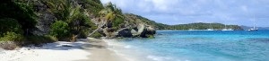
Here are some more random trip reports! CARIBBEAN SEA
From Martinique to the Grenadines, beaches, jungle, turtles and quaint villages
For your comments on the info in this page and for your ideas about trekking in Liguria, write here:
Contact info@wildtrips.net for any queries on a travel itinerary, advices about a trip report or to organize sailing holidays in Italy. Site Map - Privacy


.JPG)
.JPG)
.JPG)
.JPG)